Norfolk’s September 2016 Weather
Drought Drags On
By Russell Russ
Our last few Septembers have been weather record setters. In 2014 it was the driest and in 2015 it was the warmest. The warm and dry conditions that we have seen all summer long continued through September this year. The warmth lasted well into the third week of the month, when finally some more seasonal cooler temperatures arrived. By late in the month there were at least a couple of days when lower lying areas did see some frost, but no frost was observed at the weather station this month.
September’s high temperature of 82 degrees was observed on September 8 and the low of 36 was observed on September 26. The average mean temperature was 62.5 degrees, 3.7 degrees above normal.
There were no daily temperature records set this month, but overall it was tied with September 2007 as being the sixth warmest September in the last 85 years. The five warmest Septembers on record for the station’s 85-year history are: 2015 with 64.7, 1961 with 64.6, 2001 with 64.0, 2011 with 63.1 and 2005 with 62.9.
The near record warmth is newsworthy, but the big weather story for our region continues to be the lack of rainfall. There was just one thunderstorm observed at the station this month. Several storms just missed hitting Norfolk, which has been the case all summer long – and really all last summer as well. The rainfall total for September was 2.39 inches. While not even in the top ten for driest Septembers it was 2.29 inches below normal. This monthly deficit added to our ever increasing yearly precipitation deficit.
Through September this year, the total yearly precipitation amount was 28.21 inches. This is 11.04 inches below normal and even 3.64 inches less than last year’s total through September. The year of 2015 was pushing to be in the top five driest years, it ended up being the seventh driest. It appears that 2016 has its sights set on being the driest on record.
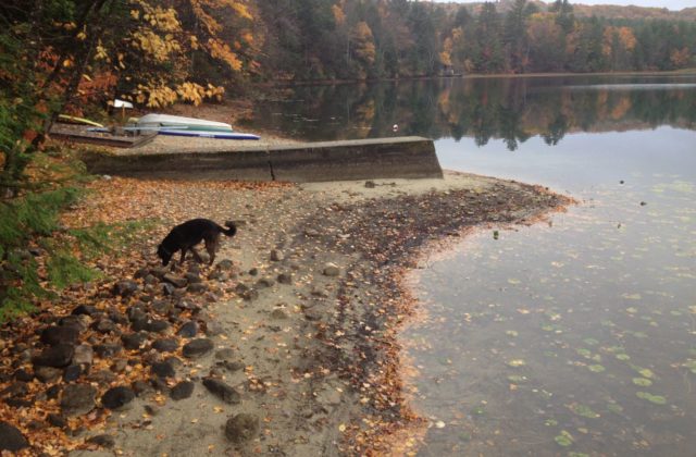
What will October’s weather be like? As of October 20, just before Norfolk Now went to print, the monthly temperature was nearly five degrees above average and the rainfall total was a meager 0.45 inches, 3.85 inches below normal. The deficit is really showing its affects. Wells are going dry and many local lake and pond levels are as low as anyone can remember. Other parts of the U.S. are seeing record rainfall amounts, but here in the Northeast it is completely the opposite. Unless conditions change drastically in the next two months, 2016 has a strong chance to be one of the top three driest years Norfolk has seen in at least 85 years – and maybe even the driest.
Weather observations are recorded by the Great Mountain Forest at Norfolk’s National Weather Service Cooperative Weather Observer Station, Norfolk 2SW.
Photo: Tobey Pond has reached historic lows, leaving a wide band of mud exposed around its periphery.

