NHCOG Releases Interactive Regional Northwest Connecticut Trail Map
A New Unified 21-Town Resource
By Billy Gridley
As Robert Frost said, “Two roads diverged in a wood, and I—I took the one less traveled by, and that has made all the difference.” A new mapping resource in the Northwest Corner has the potential to make all the difference. It already provides basic information about where to access local trails and what their special features and topographies are, and it opens possibilities for new experiences in the greater regional outdoor recreation economy.
This comprehensive trail map resource is available thanks to the Northwest Hills Council of Governments (NHCOG), a regional planning organization serving 21 municipalities ranging from Salisbury in the northwest to Burlington in the southeast. The map displays regional trails, roads, topography, hydrography and more. The project to create a unified map was launched in response to NHCOG’s 2016 Regional Transportation Plan, which considered all means of travel, including automobile, public transit, walking and bicycling.
Rick Lynn, NHCOG’S executive director said: “Trails are obvious gems in the Northwest Hills. We want residents and tourists to know more about these rich resources. With your help we will improve this map over time, highlighting opportunities for trail connectivity. Finally, we want to underscore the potential contributions that trails make to the health and quality of life in our region.” NHCOG’s mission, he says, is to “make Northwest Connecticut a better place to live, do business and visit.”
The Housatonic Valley Association (HVA) was hired as the map project consultant. After collecting trail and road data and gathering community input—in most cases, local organizations were willing to share their relevant trail data—HVA put the map on an interactive portal and added additional data, including information about parking and trail length, and ArcGIS (geographical information system) data layers (bodies of water, water quality, geology, etc.).
For example, users can click on the parking symbol for Norfolk’s Pine Mountain, get Google Map directions to the Grantville Road trailhead, and find out additional details such as parking, restrooms, picnic and camping opportunities. Over time, more features will be added, as well as links to land trusts and other local organizations. There will also be category lists—for example, five family friendly trails, five trails with scenic vistas, five longer loop trails. Rick Lynn urges users to email him at rlynn@nwhillscog.org with their suggestions and contributions; this map resource will get better through participation.
Many local organizations already have their own maps. In Norfolk, for example, you can access high-quality maps on the websites for Great Mountain Forest, the Norfolk Land Trust and Norfolk Rails to Trails. But seldom is there a “unified” trail map for any given town or region. Users often have to ferret out and cobble together the bigger picture in order to plan a special day or weekend trip. The new interactive trails map enables users to “zoom out” from consideration of a single local trail to a more holistic view of the rich tapestry of regional resources.
It is increasingly recognized that when communities invest in outdoor recreation, including basic infrastructure like high-quality trails, the result is often healthier communities and economies. The Outdoor Industry Association notes that “national parks, wildlife refuges, monuments and other public lands and waters account for $45 billion in economic output and about 396,000 jobs nationwide.”
Locally, UCONN’s 2016 Naugatuck River Greenway Study cataloged the economic and quality of life impacts that could result from the construction of a 44-mile trail through 11 municipalities from Torrington down to Ansonia and Derby. Although currently the greenway is only open in a few short, disconnected segments totaling five miles, hopes for the larger project run high.
Last July, Norfolk resident Steve Kasacek gave a talk at the Norfolk Hub entitled “Better Living Through Trails.” Kasacek, who has a background in engineering, hydrology and trail design and construction, is a passionate advocate for the benefits provided to communities by natural-surface trails and outdoor recreation.
Kasacek believes that “a trail is so much more than a colored line on a map.” In his view, a well-planned and constructed trail, created in consultation with the local community, is an enduring resource that can provide valuable experiences to many different groups. A project like Norfolk Rails to Trails, discussed elsewhere is this issue, has the initial advantage of a wide existing railroad bed, which has the potential to become a broadly accessible trail running from the center of Norfolk west toward East Canaan.
Great maps help groups of all ages and abilities explore trails. Some users seek private experiences, while others seek out community. During journeys on local highways and byways, some will be lucky enough to experience “trail magic” in the form of the kindness of strangers or the surprises and wonders of nature. And if you see a gleam in the eyes of a hiker or biker passing you by, it might just reflect the dream of a network of connected trails, crossing healthy and productive communities.
To access the Interactive Regional Trails Map, go to http://northwesthillscog.org/nhcogtrails.
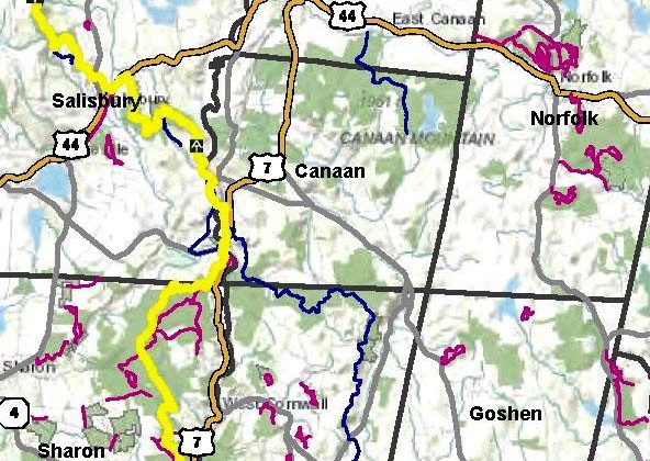
Map, top, courtesy of NHCOG.