Mapping the Future of Norfolk’s Public Trails
Project will consolidate data on every hiking path in one online site
Text by Andra Moss
Photo by Dawn Whalen
Looking for a great public trail in Norfolk? Hikers are definitely spoiled for choice, with dozens of miles of wooded paths, former carriage roads, logging trails and railway beds silently beckoning. Whatever one’s perambulatory mood, be it a challenging trek or a leisurely meander, selecting the perfect trail is about to get even easier, thanks to a new project spearheaded by the Norfolk Foundation.
Norfolk’s numerous trails are maintained by several different organizations—the State of Connecticut, Great Mountain Forest, the Norfolk Land Trust and the local branch of the Rails-to-Trails Conservancy—each of which publishes its own trail guide in varying formats and level of detail. The goal of this project, says project manager Eliza Little, is “to locate in one easily accessible and interactive site key details on every trail that is available to hike in Norfolk.”
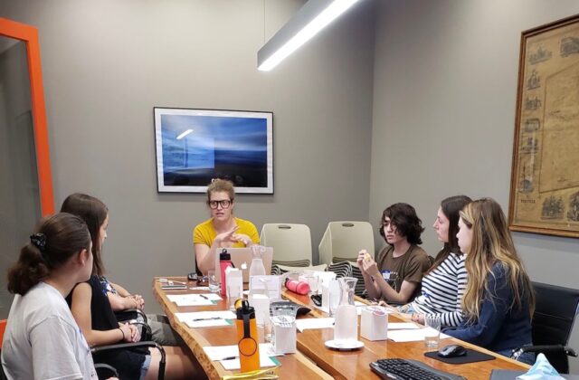
With grants from the AKC Fund and the Upper Housatonic Valley National Heritage Area, Little has activated a team of six summer interns to jumpstart a comprehensive mapping project and collect data in the app Avenza Maps for input into ArcGIS story maps, a web-based platform that stores not only trail locations and lengths but also details like elevation gain, points of geological interest, wildlife corridors and historical notes. The team is additionally noting useful trail details such as allowed use (e.g., mountain biking, cross-country skiing, etc.) and whether a hike is “family friendly” or a loop versus an out-and-back trail.
Once completed, the comprehensive, unified trail map of all Norfolk public trails can be made available as a smartphone app, website or even a print hiking guide. For added regional exposure, Norfolk’s trails could also be easily integrated into the Northwest Hills Regional Trails Viewer, an interactive hiking trail mapping project of the Northwest Hills Council of Governments (see northwesthillscog.org/nhcogtrails/).
The summer interns, says Little, “have hit the trails running.” After initial planning meetings, “We broke into teams early on so everyone has a partner to walk the trails with.” At “control central” in the Norfolk Hub, Little tries to stay at least one step ahead of her ambitious crew as they return with valuable content.
Eleanor Crone, 18, and Lauren Dauphinais, 17, both from Norfolk, have paired up to spend 20 hours per week in the field. Says Dauphinais, “It’s great exercise, although the mosquitos have been really rough after all the rain.” They recently completed walking a seven-mile stretch of trail within the Norfolk Land Trust system, where they discovered and mapped in Avenza segments of trails that the land trust had not had space to represent fully on their print maps.
“Since we can upload photos to the online map,” adds Crone, “we photograph things along the trail like wildlife and scenic views. We’re also taking videos with audio clips so that we can add in sounds like birds chirping and audio of a river that’s really beautiful.”
Fellow intern Beatrice Hayhurst, 16, notes that, as a resident of Falls Village, “I go to Great Mountain Forest quite a bit, but don’t know many other of the trails in Norfolk that well.” In addition to exploring new trails, she is especially interested in “observing how architecture interacts with the natural environment.”
Another benefit of their fieldwork, says Crone, is a greater appreciation for local history. “I always liked to hike and enjoy nature, but I never knew about all the history behind the trails.” Little agrees, noting that “much of the work has already been done by the Norfolk Land Trust. Their field guide includes so much fascinating history. Our project is more about getting this history and other information that is already out there onto one platform where everyone can access it.”
Once the comprehensive mapping is completed, Norfolk’s vibrant local hiking community will have a fully interactive trail network at their fingertips—also a boon for visitors (and, by extension, local businesses). The town will have a clear picture of its current natural resources and open spaces that can, in turn, be used to help identify future goals for preservation and conservation. Norfolk will also finally have an answer to the question of just how many scenic climbs suffused with the scent of laurel and pathways that wind through cool, damp pines can be contained in one sliver of the Northwest Corner.

