Where the Arts and Nature Meet
By Lindsey Rotolo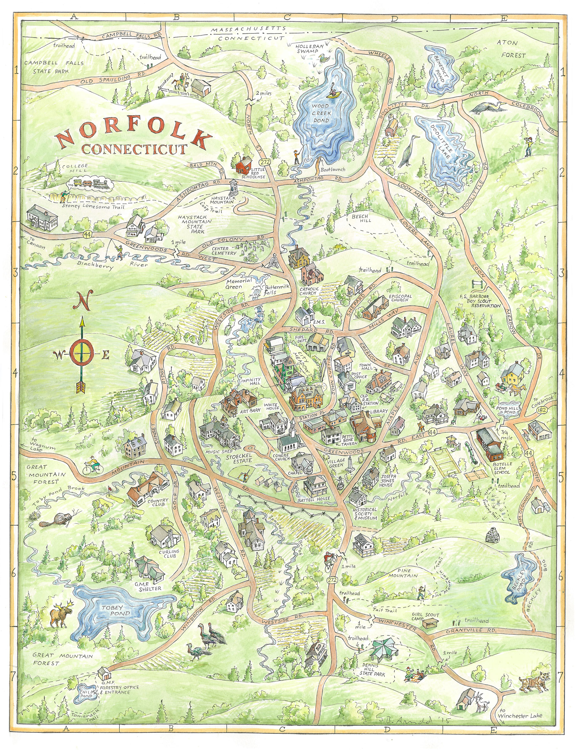
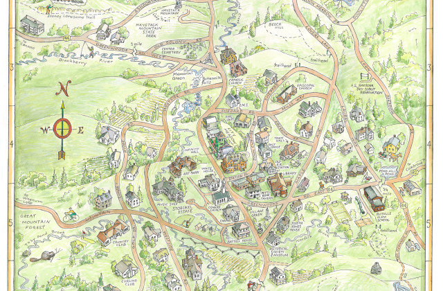
The new town map was completed in early April, through the hard work of the map committee — Sue Frish, Pete Anderson, Jim Nelson, Richard Byrne, Bella Erder and Hans Carlson. The map will be widely distributed by the second week of May. Berkshire Brochures will handle the distribution, ensuring the map’s prominence in many locations from the western Berkshires to the eastern edge of Litchfield County. Further circulation efforts will be carried out by City Media, who will deliver the map to AAA offices all over southern New England. A total of 36,000 copies were printed.
The cost of the map, including printing and distribution, ended up on budget – right around $15,000. Local businesses were very helpful in providing the necessary funding, but more financing is needed to enhance the digital version of the project.
The map highlights four “Places to Eat”, four “Music, Art & History” attractions, 14 “Shopping, Activities” locales, the bank, gas station and the three bed and breakfasts in town. Additionally, there are eight birding sites highlighted on the map, significant buildings, natural resources and some trails. The back side of the map serves as a written overview of all the town has to offer, complete with a dozen photographs. It also offers information on obtaining two additional free resources to interested parties, a Birds of Norfolk checklist and the Historical Society’s walking tour map.
A digital version of the map will be available soon on the Farmers Market website, www.norfolkfarmersmarket.org. Poster versions of the map will be available for sale this summer at Aija and Town Hall.