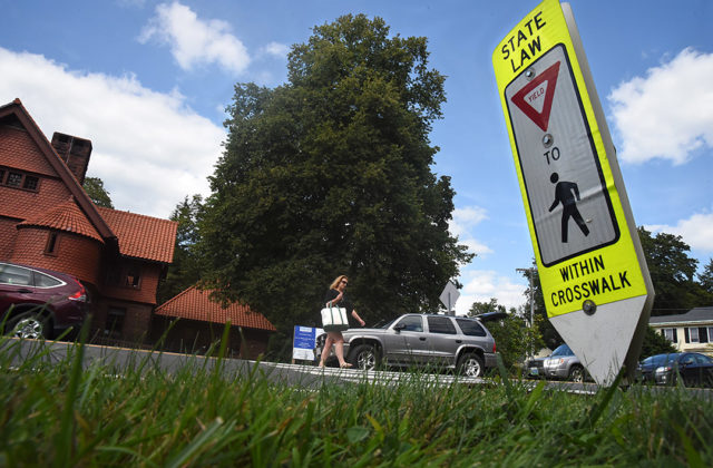
Department of Transportation Proposes New Road Safety Measures
Citizens action group formed to slow traffic through Norfolk
By Wiley Wood
Norfolk is a town cut in two by an arterial road. If you walk from the village green to the Norfolk Library or to Station Place—as many residents and Yale Music School students do—you take your life in your hands crossing Route 44. Cars whip around the 90-degree corner in front of Whitehouse with little warning, despite the posted 25 mph speed limit. And they come barreling down the hill from the other direction even faster.
In recognition of the danger, the town applied to the Connecticut Department of Transportation (DOT) for a road safety audit, which was conducted in April. The results, which include recommendations for the short, medium and long term, have just been released.
Among the more useful recommendations, First Selectman Sue Dyer pointed to proposed signage changes to mark the 25-mph zone more emphatically and the relocation of the crosswalk on Route 44 by Botelle School, moving it closer to Beacon Lane. The current location gives schoolchildren no place to congregate on the far side of the road during drills and evacuations, whereas Beacon Lane offers a gathering space.
Dyer was dismissive of other recommendations by the DOT audit team, including the placement of a movable traffic post in the middle of the crosswalk next to the Norfolk Library. That proposal, says Dyer, has been scrapped repeatedly by DOT’s own engineers because the pedestrian marker would be hit by northbound trucks making a left turn from that corner.
“It’s all because of the parking in front of the library,” says Dyer. If there were no parking on Route 44 in front of the library, turning trucks would have more clearance, and the pedestrian bollard could stay in the center of the road, at least during the summer months. “It’s complicated,” Dyer notes.
At an Economic Development Commission meeting on August 17, a citizen’s action group was formed to to address the traffic issue. William Brown, an EDC commissioner, defined the group’s task as two-pronged: on the one hand, to encourage DOT to undertake any and all measures that might make Route 44 safer to pedestrians; and on the other, to take whatever steps are possible within the community to slow down traffic through town.
Brown presented two designs that would be forwarded to the DOT for consideration. One proposes reconfiguring the junction of Routes 44 and 272 in front of Whitehouse as a T-junction governed by a traffic light. The second proposes defining “gateways” at each entrance to town, where signage would clearly and emphatically warn approaching traffic that it is entering the town area. “Because right now,” said Brown, “you don’t know you’re in Norfolk until you’re halfway through Norfolk. These would be cues that you’re in the village and should be going 25 mph.” One participant described the cluster of signs at the gateways as “a visual speed bump.”
Brown conceded that the proposals were unlikely to be adopted or acted on soon. He suggested that their real function might be to spur Connecticut DOT to come back with designs and solutions of its own.
Closer to home, the group planned to organize a massive public awareness campaign about the need to reduce speed through town. “When we had a state trooper,” says Dyer, “he found that most of the people speeding through town were Norfolk residents.” The first item of business will therefore be to try to convince Norfolkers to respect the speed limit on town roads.
A traffic radar that posts the speed of approaching cars has been discussed by Norfolk’s selectmen, but the device is expensive. “The state’s not going to put it in, and we can’t afford it,” says Dyer. Her priority at the moment is to investigate the possibility of rumble strips and pavement markers.
Photo, top, of the crosswalk in front of the Norfolk Library, by Bruce Frisch.

